Incorporating Climate Change into Landscape Connectivity Plans
Posted by
Rachel GreggProject Summary
In 2010, the Washington Wildlife Habitat Connectivity Working Group (WWHCWG) released the “Washington Connected Landscapes Project: Statewide Analysis,” which identified opportunities and priorities for conserving and restoring wildlife habitat connectivity throughout Washington State. The climate change subgroup of the WWHCWG used rigorous, science-based methodologies to incorporate the effects of climate change into the statewide analysis. The climate change subgroup began their analysis in early 2010 and results of their work include multiple reports, peer-reviewed publications, and a website.
Background
Increasing habitat connectivity is an important adaptation strategy in the face of climate change, which is expected to cause habitat fragmentation and biodiversity loss. The Washington Wildlife Habitat Connectivity Working Group (WWHCWG) conducted a collaborative scientific analysis to identify the best places to enhance habitat connectivity in order to help protect wildlife. A goal of the analysis was to use results to plan for the long-term viability of Washington’s wildlife as well as the vitality of Washington’s urban and rural communities. The WWHCWG is a voluntary public-private partnership between federal and state agencies, tribes, universities, and non-governmental organizations. The WWHCWG is co-led by the Departments of Fish and Wildlife and Transportation. Others involved include representatives from the Okanogan-Wenatchee National Forest, Washington Department of Natural Resources, Conservation Northwest, Washington Biodiversity Council, Arid Lands Initiative, Bureau of Land Management, Bureau of Reclamation, Colville Tribe, Defenders of Wildlife, Shoalwater Bay Indian Tribe, Sierra Club, The Nature Conservancy, The Wilderness Society, and Washington State Parks, among others.
In 2010, the WWHCWG conducted a connectivity analysis at the statewide scale, which was later expanded to analyze connectivity at finer scales (e.g., ecoregions). The climate change subgroup of the WWHCWG developed methodologies for integrating climate change into the results of the statewide report. GIS analysis, which incorporated downscaled climate models and climate envelope models, was used to identify corridor investments most likely to continue to provide connectivity in future climates and facilitate climate-driven shifts in species ranges. Three primary projects came out of efforts to incorporate climate change into connectivity planning: (1) Washington Connected Landscapes Project: Climate Gradient Corridors; (2) Washington Connected Landscapes Project: Climate-Resilient Corridors; and (3) The Washington-British Columbia Transboundary Climate-Connectivity Project.
Implementation
Work by the climate change subgroup of the WWHCWG was supported in part by a grant from the Wilburforce Foundation and also through government funding. Some members of the WWHCWG interested in climate change issues sought outside funding to help support the subgroup’s work. The project was motivated by a general concern within the WWHCWG in regards to climate change.
The final report on statewide connectivity, Washington Connected Landscapes Project: Statewide Analysis, includes a series of maps depicting linkage networks. These maps were derived from two modeling approaches: a focal species approach and a landscape integrity approach. The focal species approach produced maps displaying linkage networks for 16 species. The landscape integrity approach identified the best available land to maintain connectivity for the benefit of animal movement and ecological processes.
Outcomes and Conclusions
The WWHCWG has released numerous reports detailing statewide, climate change, ecoregion, transboundary, and coastal Washington landscape connectivity analyses. In addition, the WWHCWG developed two habitat connectivity GIS tools: Linkage Mapper and the Habitat Concentration Areas Toolkit (HCA). The Linkage Mapper was developed to support regional wildlife habitat connectivity analysis by automating wildlife habitat corridor mapping. The HCA automates the identification of habitat concentration areas to support regional wildlife habitat connectivity analysis.
The WWHCWG has not released new research since 2016. However, their work continues to inform decision-making and planning in Washington state. Some ways that the data, maps, and reports resulting from WWHCWG have been used include:
- Identifying least-cost corridors and habitat concentration areas for Bureau of Land Management planning;
- Transportation corridor plans and mitigation strategies for highway improvement projects;
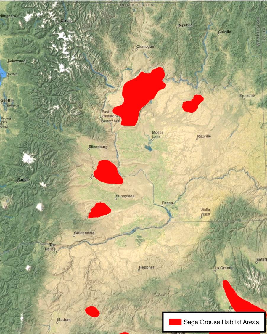
- The Cascades Carnivore Connectivity and Landscape and Genetic Connectivity of Greater Sage-Grouse in Washington projects; and
- U.S. Forest Service land management plan revisions for Okanogan-Wenatchee and Colville National Forest.
Resources:
Washington Connected Landscapes Project: Climate-Gradient Corridors Report
The Washington Wildlife Habitat Connectivity Working Group Linkage Mapper
The Washington Wildlife Habitat Connectivity Working Group Habitat Concentration Areas Toolkit (HCA)
Citation
Feifel, K. and Braddock, K.N. (2021). Incorporating Climate Change into Landscape Connectivity Plans [Case study on a project of the Washington Department of Fish and Wildlife and the Washington Department of Transportation]. Version 2.0. Product of EcoAdapt's State of Adaptation Program. (Last updated May 2021)
Project Links
Project Contacts