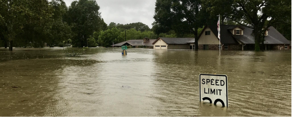
Screenshot from San Francisquito Creek Joint Powers Authority Factors Future Sea Level Rise Into Coordinated, Watershed-Level Flood Protection
Project Summary
Communities along the San Francisquito Creek are facing flooding risks from increased storm events and sea level rise. The San Francisquito Creek Joint Powers Authority is leading four main projects to stabilize, restore, and maintain the channel of the San Francisquito Creek. They are also working with upstream partners within the entire watershed, extending from San Francisco to El Camino Real, to design and plan capital projects to increase flood protection that benefits the natural environment. Projects are designed to protect against a 100-year San Francisquito Creek flood coincident with a 100-year high tide event.
Background
In general, climate change is expected to cause more intense storms and an increase in sea level. In 1998, a flood caused serious damage to roughly 1,700 properties located across the entire San Francisquito region, causing $26.6 million in property damages. In response to these threats, the cities of Palo Alto, Menlo Park and East Palo Alto, along with the County of San Mateo and the Santa Clara Valley Water District, joined to create the San Francisquito Creek Joint Power Authority (SFCJPA). SFCJPA oversees projects in the 50 square miles from the Santa Cruz Mountains to San Francisco Bay, implementing capital improvement projects and habitat restoration projects along the San Francisquito 30,000-acre watershed. Their goal is to eliminate the need for the National Flood Insurance Program, restore natural habitat for endangered and threatened species and increase recreational use.
Implementation
The SFCJPA has worked on five projects in the region to make the San Francisquito watershed area resilient to sea level rise and increased storm intensity. The five projects include the San Francisco Bay to Highway 101, Caltrans Highway 101, Upstream of U.S. Highway 101, Corps of Engineers Feasibility Study, and the SAFER Bay Project.
The San Francisco Bay to Highway 101 Project (the Downstream Project) was the initial capital improvement project of the SFCJPA, designed to reduce local flood risks during storm events and provide habitat restoration and ecological enhancement. This project was designed to increase the creek’s flow from San Francisco to Highway 101 by widening the creek’s channel, removal of an abandoned levee structure, and construction of an outlet for Caltrans’ enlargement of Highway 101. This allows water to flow from the creek channel into the Palo Alto Baylands Preserve north of the creek, restoring natural flows, preventing flooding from intense storm events, and improving streamflow from East Bayshore to San Francisco Bay. The project planned for 100-year fluvial flood flows occurring at the same time as a 10-year tide and included projected sea level rise through 2067. The Environmental Impact Report for construction plans was approved in 2012 and the project was completed in 2019. The project required relocating and upgrading critical sanitary sewer, gas, and electrical infrastructure and installation of a new recycled water pipeline. In addition, a new levee structure and floodwalls were constructed, and invasive vegetation was removed and native vegetation was planted along the levees.
The Caltrans Highway 101 Project is replacing the US Highway 101 bridge that crosses over San Francisquito Creek to increase flow capacity. Building a new bridge will accommodate a more natural flow and allow for the double-flow capacity needed to accommodate a 100-year flood event. The project was delayed from 2012–2016 due to staff constraints and project prioritization. The project recommenced in 2017 and a draft Environmental Impacts Report was released to the public in 2019. Construction is anticipated to take about 1.5 years to complete.
The Upstream of U.S. Highway 101 Project is analyzing what other restoration and capital improvements are needed upstream to provide the necessary 100-year flood protection. This project is working with the local community along with the Army Corps of Engineers to identify priority capital improvement projects. Any new construction will not start until the Caltrans Highway 101 project is completed. The Final Environmental Impact Report for this project was released in 2019.
The Corps of Engineers Feasibility Study is a Congressionally-authorized study for the San Francisquito watershed to determine the feasibility of providing flood protection, restored ecosystems, and recreational opportunities. Led by the U.S. Army Corps of Engineers, the Feasibility Study evaluated alternatives to provide flood risk management along the San Francisquito Creek and cost approximately $5,800,000.
The SAFER (Strategy to Advance Flood Protection, Ecosystems, and Recreation) Bay Project is a regional program with the same design criteria as the Downstream Project, which aims to protect against a sea level rise increase of up to 10 feet above current high tide. Phase 1 of the project is underway in East Palo Alto and Menlo Park and is funded through the California Department of Water Resources. This project is expected to protect about 1,600 properties and enable the restoration of about 600 acres of marshland.
Outcomes and Conclusions
All plans and projects led by the SFCJPA are intended to increase flood protection for the entire San Francisquito Watershed region and provide ecological benefits once completed.
Citation
A. Score & Feifel, K. (2021). Planning for Sea Level Rise in California’s San Francisquito Watershed [Case study on a project of the San Francisquito Creek Joint Powers Authority]. Version 2.0. Product of EcoAdapt's State of Adaptation Program. Retrieved from CAKE: https://www.cakex.org/case-studies/planning-sea-level-rise-california’s-san-francisquito-watershed (Last updated October 2021)
Project Contact
Len Materman
Executive Director
San Francisquito Creek Joint Powers Authority
[email protected]